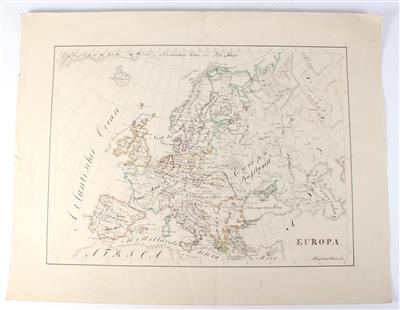
Three 19th century hand drawn Maps

signed “Mauritius Winter fecit”, comprising Great Britain and Ireland, Europe, and Kingdom Prussia. Size c. 36 x 48 cm. (WU).
Specialist: Simon Weber-Unger
 Simon Weber-Unger
+43-1-515 60-269
simon.weber@dorotheum.at
29.03.2017 - 18:00
- Starting bid:
-
EUR 200.-
Three 19th century hand drawn Maps
signed “Mauritius Winter fecit”, comprising Great Britain and Ireland, Europe, and Kingdom Prussia. Size c. 36 x 48 cm. (WU).
Specialist: Simon Weber-Unger
 Simon Weber-Unger
+43-1-515 60-269
simon.weber@dorotheum.at
|
Buyers hotline
Mon.-Fri.: 10.00am - 5.00pm
kundendienst@dorotheum.at +43 1 515 60 200 |
| Auction: | Antique Scientific Instruments and Globes |
| Auction type: | Saleroom auction |
| Date: | 29.03.2017 - 18:00 |
| Location: | Vienna | Palais Dorotheum |
| Exhibition: | 22.03. - 29.03.2017 |
